
Sidebar

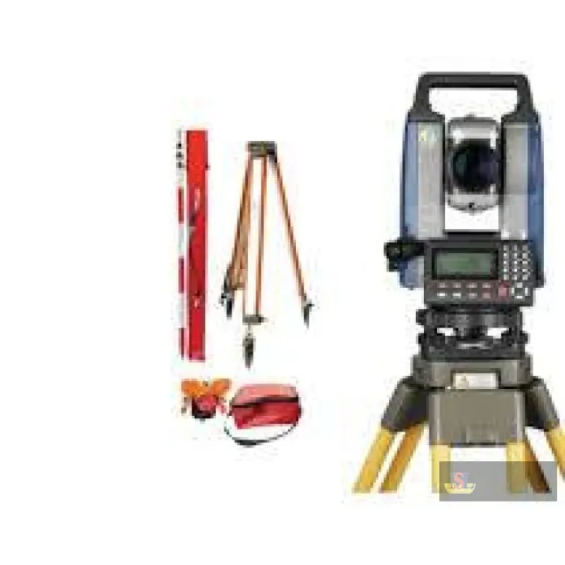


SinoGnss TS-C200 Total Station
The TS-C200 incorporating a number of innovative structures and technical improvements to achieve a 1500m non-prism range with 3mm+2ppm accuracy. Built in new ranging circuit system, the TS-C200 adopt
Categories
Quote
Account
Search
Recent View
Go to Top
All Categories
×
-
Measuring Tools
- Air Quality & Particle Meters
- Air Velocity & Manometers
- Calipers & Micrometers
- Distance Meters & Wheels
- Fiberoptic Scopes & Boroscopes
- Force, Torque & Vibration Meters
- Gas, Leak & Radiation Detectors
- Hardness, Thickness & Gloss Meters
- Home Inspection Kits
- Hydrometers
- Insulation, Resistance & Capacitance Testers
- Light, Sound, Moisture & Environmental Meters
- Multimeters, Clamp Meters & Electrical Testers
- pH, Conductivity & TDS Meters
- Pressure Gauge
- Refractometers & Heat Stress Meters
- Tachometers & Stroboscopes
- Tape Measures
- Test Meter Calibration Kits
- Thermal Imagers & Infrared Thermometers
- Thermo-Hygrometers & Psychrometers
- Thermocouples & Digital Thermometers
- Weighing Scales
- Measuring Tools Accessories
-
Survey Accessories
- Batteries & Chargers
- Binoculars
- Bipods & Tripods
- Calculators
- Compass
- Drafting Supplies
- Education
- Field Cases
- Flash Cards & Usb
- Glasses, Wall Mounts & Accessories
- GNSS Accessories
- Instrument Tripods
- Lasers & Leveling Rods
- Power, Antennae & Data Cables
- Prism Pole & Rod Accessories
- Prism Poles
- Prisms & Assemblies
- Rover Rods
- Safety Clothes & Field Supplies
- Survey Accessories
- Tribrach & Adapters
- Vials & Levels
- Walkie Talkie Radios
-
Survey Equipment
- 3D Handheld Laser Scanners
- Airborne LiDAR Systems
- Car Navigation Systems
- Cors
- Detection Tools
- Digital Levels
- Field Controllers & Tablets
- GNSS Antennae
- GNSS External Datalinks
- GNSS Handhelds
- GPS Handhelds
- GPS Tracker
- Ground Penetrating Radar
- Indoor Navigation Systems
- Integrated GNSS Receivers
- Laser Levels
- Laser Receivers
- Mobile Mapping Systems
- Optical Levels
- Surveying & Mapping Software
- Theodolite
- Total Stations
- Unmanned Aerial Vehicles UAVs
- Unmanned Surface Vessels USVs
Quote Request
×
Your quote request is empty!
Search
×
Recent View Products
×
Has no content to show !
Product Description
The TS-C200 incorporating a number of innovative structures and technical improvements to achieve a 1500m non-prism range with 3mm+2ppm accuracy. Built in new ranging circuit system, the TS-C200 adopts an ultra-low noise broadband amplifier with independent intellectual property rights. The mechanical structure features an integrated CCD and a double-bead shaft for the horizontal and vertical axes, which benefits the angular accuracy up to 2’’.
Featuring advanced noise phase analysis algorithm, the TS-C200 greatly reduces the interference of various noises on the phase measurement results under bad weather and weak signal conditions. The optical path design fully isolates the transmitted and received optical signals, further ensured high accuracy. The road measurement program can calculate horizontal and vertical road curves of any line type, and allows discontinuous change in radius of horizontal curve.
TS-C200 can transmit data bidirectionally with PC through bluetooth, and be controlled through field software such as Field Genius. TS-C200 comes with a U disk interface, which can import and export data from the U disk. SD card is optional to expand the memory to store more measurement data.
Clear interface supports EXCEL and DAT file import/export; It displays 19-bit code, which makes the road stakeout point information clear at a glance; The users can add known point files, and invoke the coordinates of the known point for all the projects. Loaded with a variety of programs to meet a variety of needs.
Featuring advanced noise phase analysis algorithm, the TS-C200 greatly reduces the interference of various noises on the phase measurement results under bad weather and weak signal conditions. The optical path design fully isolates the transmitted and received optical signals, further ensured high accuracy. The road measurement program can calculate horizontal and vertical road curves of any line type, and allows discontinuous change in radius of horizontal curve.
TS-C200 can transmit data bidirectionally with PC through bluetooth, and be controlled through field software such as Field Genius. TS-C200 comes with a U disk interface, which can import and export data from the U disk. SD card is optional to expand the memory to store more measurement data.
Clear interface supports EXCEL and DAT file import/export; It displays 19-bit code, which makes the road stakeout point information clear at a glance; The users can add known point files, and invoke the coordinates of the known point for all the projects. Loaded with a variety of programs to meet a variety of needs.
- 2" Angle Measurement
- 30x Telescope Magnification
- Dual Axis Compensation
- 0.1″/1″/5″/10″ Minimum Increment
- Compensator Range ±3'
- Up to 1500m Without Prism
- Up to 5000m With Prism
- 1.2m Minimum Focusing Distance
- 2mm+2ppm Prism Accuracy
- 3mm+2ppm Non-Prism Accuracy
- Fast and Reliable Measurement
- Tilt Sensor: Dual Axis Liquid-Electric (working range: ±3′, accuracy: 1″)
- Atmosphere Correction: Manual Input, Auto Correction
- Prism Constant: Manual Input, Auto Correction
- Communications: USB Port, BlueTooth, SD Card
- Plummet: Laser Plummet, 5-Levels Adjustment
- Screen Type: 320*240 Dot matrix high-definition high-brightness display
- Keyboard: Alphanumeric
- Digital Display:Maximum:99999999.9999 & Minimum:0.1mm 4 decimal places optional)
- Comnav TS-C200 Total Station