
Survey Equipment
-
 3d Handheld Laser Scanners
-
Airborne LiDAR Systems
-
Airborne Lidar Systems
-
Car Navigation Systems
-
Cors
-
Digital Levels
-
Field Controllers & Tablets
-
Gnss Antennae
-
Gnss External Datalinks
-
Gnss Handhelds
-
Gps Handhelds
-
Gps Tracker
-
Ground Penetrating Radar
-
Integrated Gnss Receivers
-
Laser Levels
-
Optical Levels
-
Structural Monitoring Systems
-
Surveying & Mapping Software
-
Theodolite
-
Total Stations
-
Unmanned Aerial Vehicles UAVs
-
Unmanned Aerial Vehicles Uavs
-
Unmanned Surface Vessels USVs
-
Unmanned Surface Vessels Usvs

Geoelectron Surpad Field Software
The official SurPad app logo/branding — SurPad 4.2 is the Android field data-collection software commonly bundled with Geoelectron and other Chinese R..

Goslam Color Module, Instar X5 Camera
The Instar X5 is a colour add-on camera module that clips onto compatible GoSLAM scanner bodies to add high-resolution colour imaging for true-colour ..
Goslam Gs-fm Extension Rod
GoSLAM's handheld extension pole lets an operator hold the scanner higher or further out to reach over obstacles, into stairwells, or above crowds whi..
Goslam Gs-us400 Drone Mount Kit for Dji M350
GoSLAM's UAV mounting kit attaches a compatible scanner underneath a drone airframe such as the DJI M350 for aerial LiDAR mapping.
Goslam M40 Mobile 3d Laser Scanner
The GoSLAM M40 is a lightweight handheld mobile mapping scanner using fixed-LiDAR SLAM technology, rated for a 70m scan radius and roughly 1cm accurac..
Goslam M40 Rtk Mobile 3d Laser Scanner
This is the M40 body fitted with an integrated RTK positioning module, adding survey-grade absolute georeferencing to the same 70m-range handheld LiDA..
Goslam T100i Mobile 3d Laser Scanner
The T100i extends the T-series design to a 120m scanning radius while keeping roughly 1cm point accuracy, using laser-SLAM so it needs no external GNS..
Goslam T100i Pro Mobile 3d Laser Scanner
The Pro variant of the T100i adds an 8K HDR panoramic colour camera and survey-grade true-colour point cloud output on top of the same 120m-range scan..
Goslam T300i Pro Mobile 3d Laser Scanner
The T300i Pro is GoSLAM's long-range flagship, with 32 laser lines, a 300m scanning distance, 640,000 pts/sec speed, roughly 1cm accuracy, plus a buil..
Goslam T50i Mobile 3d Laser Scanner
The GoSLAM T50i is a portable mobile scanner with a rotating laser probe rated to a 50m radius at about 1cm accuracy, paired with a colour touchscreen..
Goslam Underground Laser Positional Module
GoSLAM's dedicated underground/mine positioning module, used to maintain accurate scanner localisation in tunnels and other GNSS-denied underground en..
Goslam X1 Mobile 3d Laser Scanner
The GoSLAM X1 is a compact, collision-resistant drone-mounted LiDAR unit built for flying 3D laser scans through narrow, hard-to-reach spaces, streami..
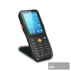
Jepower Ht380k Android Controller
The Jepower HT380K is a rugged Android handheld PDA/data terminal with a 3.5-inch touchscreen, physical numeric keypad, octa-core processor, and integ..

Microsurvey Field Genius Software for Android
FieldGenius for Android brings the same MicroSurvey data-collection engine to Android tablets and rugged Android controllers, letting surveyors run ro..

Microsurvey Field Genius Software for Windows
FieldGenius for Windows is MicroSurvey's field data-collection software for land surveyors and construction crews, running on rugged Windows handhelds..
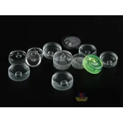
Muya Bl02 Bubble Level for Pentax Total Station
A round glass bubble vial sized as the replacement circular level for a Pentax total station.
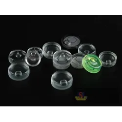
Muya Bl04 Bubble Level for Leica Total Station
A round glass bubble vial sized as the replacement circular level for a Leica total station.
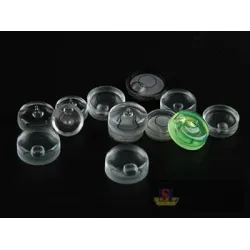
Muya Bl05 Bubble Level for Leica Total Station
A round glass bubble vial sized as the replacement circular level for a Leica total station, an alternate part-number equivalent to BL04.
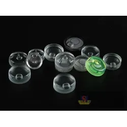
Muya Bl06 Bubble Level for Leica Digital Level
A round glass bubble vial sized as the replacement circular level for a Leica digital level.
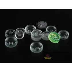
Muya Bl07 Bubble Level for Geomax Digital Level
A round glass bubble vial sized as the replacement circular level for a Geomax digital level.