Any application asking questions with “where” for any object on the earth surface can be answered by GNSS and CORS technologies.
Most people around the world and Kenya are currently using standalone GNSS/GPS devices in various positioning applications mostly low accuracy applications. The CORS however helps to improve the positioning accuracies up to millimeters level applications.
- ALL applications requiring high positioning accuracies, say below 10cm, would require RTK corrections from CORS with fixed solutions. These includes boundary and engineering mapping, monitoring of natural and manmade structures, geodynamics, precision faming.
- All applications requiring sub meter accuracies, say below 1m, DGPS corrections from CORS with Float solutions.
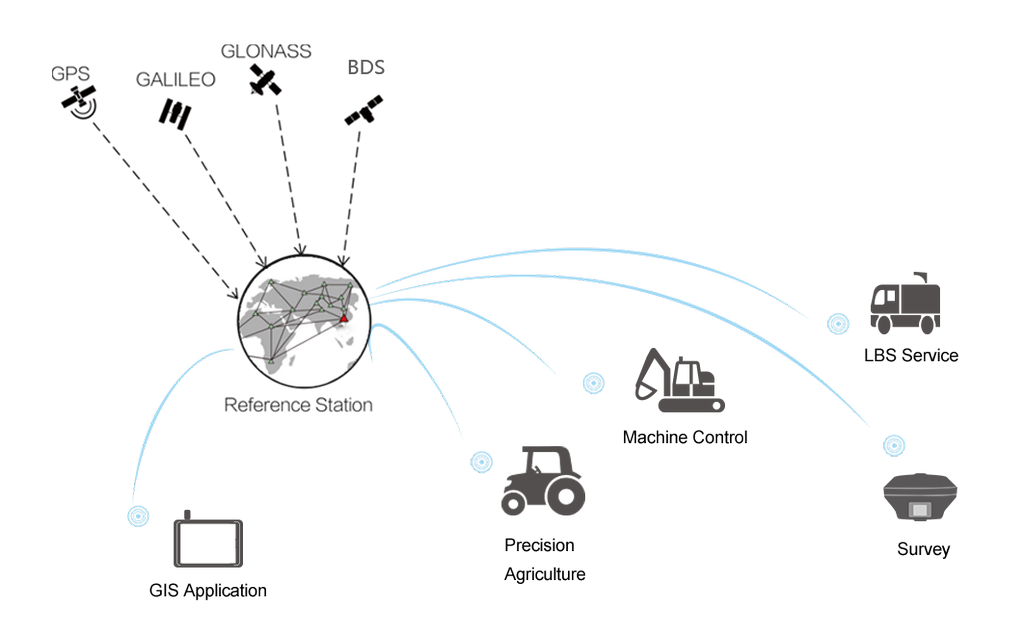
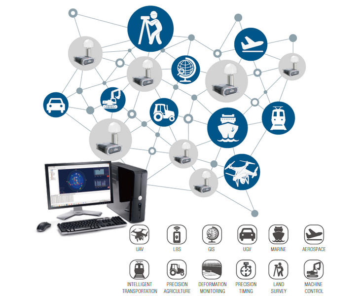
GNSS and consequently CORS find some of their general applications in: surveying, mining and quarrying, construction and civil works, navigation, land use and management, vehicle tracking, infrastructure, Precision Agriculture, emergency state management, traffic management, mobile applications, city and regional planning, forest and environmental management, e-government, and scientific research.
The primary use of the CORS network is survey work which is meant to ensure accurate positioning of land parcels, densification of national geodetic control networks, and to locate, map and direct the construction of infrastructure such as roads, railways, mines, bridges, dams and pipelines.
Survey data also helps government agencies, local government and utility organizations to improve the integrity of the recorded locations of their assets. It is also an essential input for the design, construction and maintenance projects of engineering, mining, road, rail, electricity, water and gas utility companies.
Table below, details the activities that are carried out in each of these application areas:
Critical GNSS Application Areas
| APPLICATION FIELD | SPECIFIC AREAS OF APPLICATION |
| Surveying | Geodetic Surveying & mapping – establishment, densification, maintenance of national geodetic networks; establishment and maintenance of national geoidal models and height networks. |
| Cadastral surveys – establishment of survey control points, relocation of property boundaries, subdivision and consolidation of properties. | |
| Topographical surveys – determination of elevations and positions of points and features of interest so as to produce topographic or large-scale maps showing an area’s terrain and other required detail. | |
| Engineering Surveys – determining the absolute and relative positions of features existing on the site of the proposed works, setting out, monitoring and deformation surveys, maintenance of infrastructure and facilities, machine guidance, and as built surveys (showing the actual positions of works as constructed). | |
| Mining | Exploration, Surface surveying, Monitoring of ground surface response to resource extraction, machine guidance, collision avoidance. |
| GNSS Location Based Services | Cargo Fleet Tracking, Fleet Control/Dispatch, Emergency Operations, Road Maintenance, In Vehicle Navigation, GNSS Positive Train Control, GNSS Maritime Applications, GNSS Recreation Applications, Aero navigation. |
| Defense and public security | Food security; emergency response; disaster management. |
| Geodynamics | Local deformation monitoring and geohazard studies, Crustal motion and continental deformation monitoring. |
Agriculture | Precision farming, National crop assessment. |
| Climate | Determination or retrieval of Precipitable Water Vapor (PWV) in real-time, capturing the signature of severe weather events. |
| Scientific research | inter/intra tectonic plate deformation, sea level monitoring, climate change, Ionospheric and tropospheric Studies. |
| Geolocation of Aerial Moving Platforms | Remote sensing applications, positioning of aircrafts employed in aerial mapping, mapping terrain applications using cutting edge technologies such as scanning radar, light detection and ranging (LiDAR), inertial systems, interferometric synthetic aperture radar, and/or sonar. |